London: land change, 2016–2025
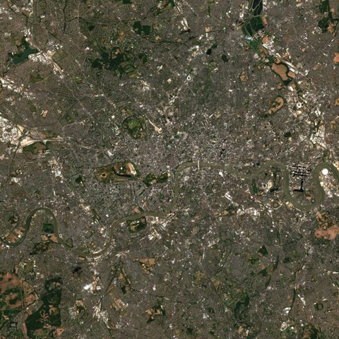
Two Sentinel-2 satellite images of a 20 km square around London, from 2016-08-12 and 2025-07-11, were classified by a ResNet18 model trained on EuroSAT. Every 640 m cell is put in one of four land-cover groups, and the two dates are compared cell by cell.
- Before
- 2016-08-12
- After
- 2025-07-11
- Area analysed
- 394 km²
Change
+4.7 km²net change in built-up area
In cells the model is sure of on both dates (confidence ≥ 0.8): 7.8 km² became built-up, 13.9 km² changed in total.
Land cover on both dates
| 2016 | 2025 | ± | |
|---|---|---|---|
| Agriculture increased | 0.7% | 1.8% | +1.1 |
| Natural vegetation decreased | 39.8% | 37.3% | -2.5 |
| Built-up increased | 57.9% | 59.1% | +1.2 |
| Water no notable change | 1.7% | 1.9% | +0.2 |
Largest transitions (confident cells)
- Natural vegetation → Built-up7.8 km²
- Built-up → Natural vegetation4.9 km²
- Natural vegetation → Agriculture0.8 km²
- Water → Natural vegetation0.4 km²
Limits
- Every value shown is a model estimate, not a measurement.
- Areas are not measurements but approximations counted from cells. The figures are always computed on 640 m cells; the scale only changes how the map is drawn.
- The model was trained on European images; results outside Europe are less reliable.
- Clouds, shadows and seasonal differences can show change that is not there.